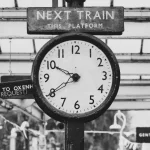
Beijing and Manila sit roughly 2,700 kilometers apart, separated by open ocean, an entirely different government, and no shared border of any kind. Their clocks agree anyway, down to the minute, every single day of the year. That isn’t a coincidence, and it isn’t a political alignment either. It’s a quirk of geometry that most people never think to check: distance and longitude are not the same question, and time zones only ever answer one of them.
Distance and Longitude Aren’t the Same Question
A time zone is fundamentally a statement about east-west position, nothing else. Beijing sits at roughly 116 degrees east longitude; Manila sits at roughly 121 degrees east. That’s a gap of only about five degrees, comfortably inside the same UTC+8 band that covers a considerable stretch of East Asia. The 2,700 kilometers separating the two cities is mostly a north-south measurement, Beijing sits more than 25 degrees of latitude further from the equator than Manila does, and latitude has no bearing on what time zone a place falls into. Two cities can feel worlds apart on a map and still sit on nearly the same meridian, which is exactly what’s happening here. The same UTC+8 band also covers Singapore, Malaysia, Hong Kong, and part of Western Australia, none of which border each other either; distance across water has simply never been what time zones measure.
The Day the Philippines Skipped a Day
The Philippines didn’t arrive at its current alignment with Asia by accident, and the story starts nowhere near China at all. For 250 years, from 1565 to 1815, the Manila-Acapulco Galleon Trade tied the Philippines to Mexico, with ships crossing the Pacific from the Americas rather than from anywhere in Asia. Because those ships carried the calendar with them, the Philippines kept a date that matched Spanish America rather than the Asian neighbors surrounding it, even though it sat physically in the middle of Southeast Asia. The practical result was strange enough to notice: a Sunday in Manila was already Monday in Batavia, modern Jakarta, a city barely 1,700 miles to the south.
The Mexican War of Independence cut the Galleon Trade off around 1815, and as Philippine commerce increasingly shifted toward China and the Dutch East Indies over the following decades, being a full calendar day behind its actual trading partners turned from a curiosity into a real problem. For as long as the arrangement held, mapmakers drew the era’s informal date boundary as a strange, deliberate detour: rather than running in a straight line down the Pacific the way it does today, it curved sharply west around the Philippines specifically to keep the islands paired with Spanish America instead of their own immediate neighbors. Governor-General Narciso Clavería y Zaldúa, after consulting with Archbishop José Seguí, issued the fix on August 16, 1844. Monday, December 30 of that year, was followed directly by Wednesday, January 1, 1845. Tuesday, December 31, 1844, simply never happened in the Philippines.
The Philippines didn’t just move a clock. It deleted a day from its own history to stop living on Mexico’s calendar. worldtimedata
The timing is what makes the story remarkable: the boundary the Philippines had just aligned itself with, what would later become the International Date Line, wasn’t formally established until 1884, forty years afterward. The Philippines had already placed itself firmly on the Asian side of that eventual line before the line was even officially real, and for decades afterward, some cartographers elsewhere in the world still hadn’t caught up, continuing to mark the islands on the wrong date entirely.
American Standardization, Then a Wartime Interruption
The 1844 switch fixed the date; the specific hourly offset came later, under American colonial administration. In 1901, the Philippine Commission’s Act No. 245 formally established Philippine Standard Time, driven less by astronomy than by the practical needs of railroads, shipping schedules, and telegraph coordination, all of which needed one reliable clock rather than a patchwork of local solar times. The name itself created a small, permanent point of confusion: Philippine Standard Time is still officially abbreviated PST in some documents, the exact same three letters used for US Pacific Standard Time on the opposite side of the globe, which is why Philippine sources increasingly favor PHT instead.
A brief experiment with daylight saving followed under President Manuel Quezon, advancing clocks for three months from November 1936 to January 1937, framed at the time as an energy-saving measure. It was abandoned for a reason almost the mirror image of why high-latitude countries eventually reject seasonal clock changes too: sitting so close to the equator, the Philippines’ daylight hours barely shift across the seasons at all, holding near a steady 12 hours year-round, so the trial produced no measurable drop in electricity use and left a seasonal clock shift with essentially nothing to accomplish.
World War II interrupted the arrangement outright. Japanese occupying forces shifted the Philippines onto Tokyo Standard Time, an hour ahead of the country’s own standard, starting May 1, 1942. The change held until Allied forces liberated the Visayas in late October 1944, after which Philippine clocks were reset back to UTC+8 within days. Independence followed in 1946, and the country simply kept the standard it already had.
Why UTC+8 Was Never a Coincidence for Either Country
What makes the Philippines-China alignment work isn’t luck on either side. Philippine territory sits entirely between about 117 and 127 degrees east longitude, squarely inside UTC+8’s natural range from the moment anyone drew that band on a map; the Philippines was never stretched onto an offset that didn’t fit its own geography. China’s situation is different, and the more famous half of this comparison: eastern China, including Beijing, sits naturally in the same UTC+8 band, but the country’s single legal time zone stretches across territory running thousands of kilometers further west, land that would naturally belong to zones several hours earlier. China chose administrative unity over solar accuracy for its far west. The Philippines never had to make that tradeoff at all, because its entire archipelago already belonged to UTC+8 on its own terms. The two countries end up sharing a clock not because one bent itself to match the other, but because a Manila meridian and a Beijing meridian were always going to be close, regardless of how much open water and how many degrees of latitude happened to sit in between.
The practical payoff of that accident is one modern businesses lean on daily without necessarily knowing why it exists. A call center in Manila, a factory floor in Shenzhen, and a trading desk in Hong Kong can all schedule a meeting for 9 a.m. without a single time zone conversion between them, a convenience that traces back through a wartime occupation, a failed equatorial daylight experiment, and, right at the root of it, one governor-general who decided the fastest way to fix a calendar was to simply delete a day from it.