Major Airports in Micronesia
- Chuuk International Airport (TKK) - 08:35:21
- Kosrae International Airport (KSA) - 10:35:21
- Yap International Airport (YAP) - 08:35:21
Daylight saving time in Micronesia
Micronesia has 1 listed IANA time zones. None of them observe daylight saving time in 2026. The UTC offset remains stable throughout the year.
Best Time to Call Micronesia
Business hours in Micronesia (9 AM–5 PM local time) fall at these local times elsewhere:
- Beijing: 6:00 AM – 2:00 PM ( Partial overlap)
- Paris: 12:00 AM – 8:00 AM ( Outside normal hours)
- Toronto: 6:00 PM (previous day) – 2:00 AM ( Partial overlap)
- Seoul: 7:00 AM – 3:00 PM ( Partial overlap)
- Mexico City: 4:00 PM (previous day) – 12:00 AM ( Partial overlap)
- Cairo: 1:00 AM – 9:00 AM ( Outside normal hours)
- Bangkok: 5:00 AM – 1:00 PM ( Outside normal hours)
Times shown reflect current UTC offsets and may shift by up to an hour around daylight saving transitions.
Time Difference from Micronesia
Compare time in Micronesia with other countries.
Countries in the Same Time Zone as Micronesia
Most Popular Cities in Micronesia
Holidays in Micronesia
Official national public holidays. Regional and religious observances may vary by area.
About Time in Micronesia
Carolinian Navigators Can Measure a Voyage by Imagining an Island Moving Backward
On the outer islands of the Federated States of Micronesia, some of the most sophisticated traditional measurements of time and distance were developed for a place where neither could be marked on the landscape. Once a canoe left an atoll, there might be nothing visible ahead for hundreds of kilometers except sea and sky.
Carolinian navigators solved that problem without charts, magnetic compasses or mechanical instruments. UNESCO documents the survival of this wayfinding tradition particularly in the outer islands of Yap State, where navigators still combine stars, swells, winds, currents, clouds and other environmental signals to cross open ocean.
The star compass provides the directional framework. Ethnographic studies of Satawal and neighboring islands describe a mental horizon divided into 32 directional points associated with the rising and setting positions of selected stars. A navigator memorizes the courses connecting islands and can change from one stellar reference to another as the night progresses.
Direction alone does not tell a navigator how much of the voyage has been completed. A remarkable Carolinian technique known as etak addresses that problem. The canoe is imagined as remaining stationary while a third, reference island moves backward across the star compass. As that imaginary island passes successive stellar bearings, the voyage is divided mentally into sections.
This reverses the obvious visual logic of travel. The navigator knows that the canoe is moving, yet the mental model keeps the canoe fixed and moves the surrounding world instead. Speed, elapsed travel, currents and the expected position of the destination can then be integrated into one remembered spatial sequence.
Time is present even when no clock is consulted. If wind weakens, current changes or the canoe slows, the navigator must adjust the expected rate at which the imagined reference island progresses through its sequence. Distance travelled is therefore estimated through a combination of environmental observation and accumulated time rather than through a numerical speedometer.
The knowledge requires years of apprenticeship. Routes, star bearings, swells, reef patterns, birds, weather signs and the locations of islands that may never become visible during a particular voyage must be memorized as one connected system. UNESCO placed Carolinian wayfinding and canoe making on the List of Intangible Cultural Heritage in Need of Urgent Safeguarding in 2021 because only a limited number of master navigators and canoe builders remain.
Three Months Underground Could Preserve Breadfruit for Years
Pohnpei's traditional food calendar contains a solution to a basic island problem: an abundant crop can appear for only part of the year, while people need food every day. Breadfruit is highly productive but seasonal, so surplus fruit was historically converted into food that could survive long after the trees stopped producing.
FAO documentation of Pohnpei's traditional food system places the principal breadfruit season roughly from October through February. The island also preserves extraordinary crop diversity, including more than one hundred documented breadfruit varieties, whose different characteristics and fruiting periods could spread production across the season.
One preservation method turned the harvest into a much longer resource. Large quantities of breadfruit were peeled, cored and placed in lined earthen pits. Historical descriptions record pits holding approximately 500 to 1,000 fruits at a time.
The transformation was slow. Fermentation required roughly three months before the breadfruit became a dough-like preserved food traditionally known as mahr. After that initial period, however, the material did not need to be consumed immediately. Properly maintained stores could remain underground for years.
The method effectively separated harvest time from eating time. Fresh fruit that might otherwise spoil soon after ripening could cross the months when breadfruit trees carried little or no crop. The same reserve also provided insurance after typhoons or other disasters damaged trees and interrupted the next harvest.
This produced an unusual food clock. A tree determined when fresh fruit became available, fermentation imposed another interval of about three months, and storage extended the usable life of the crop across multiple seasons. Instead of forcing households to consume abundance when it arrived, preservation allowed one productive season to feed another.
In February 1998, Drought Made Groundwater Flow the Wrong Way on Kosrae
The 1997-1998 El Niño produced an unusually severe dry period across parts of Micronesia. On Kosrae, researchers had already installed instruments in a mangrove forest and adjacent freshwater swamp, allowing them to watch the hydrological system change as rainfall disappeared.
The strongest drought effects occurred from January through April 1998. Compared with the wetter period from May through December, mean groundwater levels fell by about 12 centimeters in the mangrove area and approximately 54 centimeters in the freshwater swamp.
February produced the most surprising result. Under normal conditions, fresh groundwater moved toward the coast and helped keep mangrove groundwater relatively dilute. At the height of the drought, the hydraulic gradient reversed. Groundwater began moving from the mangrove area inland toward the freshwater swamp.
Salinity changed with it. Measurements from shallow wells during low tide averaged about 14.7 parts per thousand during the drought, compared with roughly 6.2 after rainfall recovered. In other words, mean salinity in those measurements was more than twice as high during the dry period.
This reversal shows why several dry months can matter far more on a small island than the same rainfall deficit might suggest on a continent. Freshwater exists in a limited system surrounded by seawater. Once recharge weakens, the balance between inland water and marine influence can reorganize quickly.
The wider Federated States of Micronesia faces the same temporal vulnerability in different forms. USGS research notes that even islands receiving very high annual rainfall can enter serious water emergencies during the months following a strong El Niño. Atolls are particularly exposed because freshwater lenses are thin and households often depend heavily on rainwater catchments.
Drought therefore has a delayed rhythm. El Niño develops across the Pacific, rainfall declines months later, stored rainwater is consumed, groundwater levels continue falling and salinity can increase before normal precipitation finally returns. On Kosrae in 1998, that progression became strong enough to reverse the direction of groundwater itself.
At 10:25 on 9 April 2004, Sudal's Eye Was Crossing Southern Yap
Typhoon Sudal began as a tropical depression west-southwest of Chuuk on the morning of 4 April 2004. Over the following five days it crossed a chain of widely separated islands, strengthening as it moved westward through the Federated States of Micronesia.
The developing storm passed over Puluwat during the night of 4 April and moved between Satawal and Ulul around midday on 5 April. By the afternoon of 6 April it had become a typhoon.
Yap experienced the most destructive phase. NOAA satellite imagery at 00:25 UTC on 9 April, 10:25 local time on Yap, showed Sudal's eye passing across the extreme southern end of the island. The eyewall affected Yap for roughly four to five hours.
The difference across an island only a few kilometers wide was striking. NOAA's post-storm analysis reconstructed Category 1 conditions in the north, Category 2 winds across central Yap and Category 3 conditions toward the southern end. About 7.95 inches of rain were measured at Yap Airport during the storm.
Damage accumulated within those hours. More than 90 percent of buildings and other structures were damaged or destroyed. Of approximately 1,700 residences, about 700 were destroyed; among the remaining thousand, only 41 escaped damage. The hospital, airport, government facilities, electricity, water and communications systems were severely affected.
Storm surge along the eastern and southern coastline reached approximately 8 to 12 feet, while surf reached around 22 feet. Salt water contaminated agricultural land and freshwater supplies, and most subsistence crops were destroyed. About 1,500 residents sought shelter, including roughly 1,000 who were left homeless.
Yet no direct deaths were recorded in Yap State. Sudal is therefore a useful case in disaster timing: a cyclone that developed over several days produced its most severe local consequences during a few hours, while recovery of homes, crops, water systems and public infrastructure required months or years.
Pingelap Stores About 384 Million Gallons of Fresh Water Beneath a Tiny Island
On a low coral island, the most important reservoir may be invisible. Pingelap Island in Pohnpei State sits above a lens of fresh groundwater floating on denser salt water beneath the island.
A USGS investigation estimated that the potable portion of this freshwater lens contained about 384 million gallons. Average rainfall of roughly 160 inches per year supplied an estimated 230,000 gallons of groundwater recharge per day.
Those large numbers can be misleading without a time dimension. Recharge is not available uniformly every day. Rain arrives irregularly, households consume water continuously and drought can interrupt replenishment for weeks or months.
USGS estimated a long-term sustainable groundwater yield of about 69,000 gallons per day, compared with an estimated island demand near 50,000 gallons per day at the time of the study. The apparent margin existed only because the calculation averaged recharge and use across a much longer period.
The recommended water system therefore combined two clocks. Rainwater catchments could supply drinking and cooking water when precipitation was available. Groundwater could serve other needs and become an emergency reserve when prolonged dry weather emptied the tanks.
This strategy reflects the hydrology of an atoll. Pumping too much groundwater too quickly can draw saltier water upward or inland, reducing the useful freshwater thickness. A reserve measured in hundreds of millions of gallons can still be vulnerable if withdrawal during a drought exceeds the rate at which rainfall can eventually replace it.
Pingelap's water supply is thus governed less by total storage than by rates: rainfall per day, recharge per day, consumption per day and the duration of the dry interval between storms.
Crossing the Federated States of Micronesia Can Also Mean Crossing an Hour
The country's modern civil time reflects its extraordinary east-west spread across the western Pacific. Yap and Chuuk States use UTC+10, while Pohnpei and Kosrae use UTC+11. No part of the country currently observes daylight saving time.
The boundary means that the same instant carries two official clock readings inside one country. When it is 08:00 on Yap or Chuuk, it is already 09:00 on Pohnpei and Kosrae. National institutions coordinating meetings, flights, weather warnings or broadcasts across states therefore have to account for an internal one-hour difference.
The split is especially visible in weather operations. The U.S. National Weather Service office responsible for tropical cyclone warnings in the region explicitly separates the Federated States of Micronesia at approximately 154 degrees east: Yap and Chuuk lie in the UTC+10 operational zone, while Pohnpei and Kosrae use UTC+11.
IANA maintains separate identifiers for these clocks, including Pacific/Chuuk, Pacific/Pohnpei and Pacific/Kosrae. The separate identifiers are useful because historical records are less simple than the modern two-offset arrangement.
Database maintainers themselves warn that some older transitions in Micronesia are incompletely documented. Earlier versions of the time-zone data contained uncertain assumptions about when individual islands adopted particular offsets. That uncertainty makes it risky to project today's clean UTC+10 and UTC+11 division backward through every historical timestamp.
The modern arrangement, however, is straightforward. A country with a land area small enough to fit inside many large cities is spread across so much ocean that its national day has two simultaneous clock readings.
Frequently Asked Questions
How many time zones does Micronesia have?
One. The whole of Micronesia follows Pacific/Pohnpei, so every city shows the same local time as the capital, Palikir.
Is Micronesia ahead of or behind GMT?
Micronesia is currently 11 hours ahead of GMT (UTC+11).
Does Micronesia use summer time?
No. Micronesia does not observe daylight saving time, so its clocks stay at UTC+11 all year. Its time difference with countries that do change their clocks still shifts by an hour in spring and autumn.
How many public holidays does Micronesia have in 2026?
Micronesia has 10 national public holidays in 2026, when banks and government offices are usually closed. Some regions may also have their own local holidays.
How do I dial a phone number in Micronesia from abroad?
From a mobile phone, type +691 and then the local number without the leading 0 used for domestic calls, if it has one. From a landline, replace the plus sign with your exit code: 011 from the US and Canada, or 00 from most of Europe, for example 00 691 followed by the number.
What language is spoken in Micronesia?
The main languages of Micronesia are English, Chuukese and Pohnpeian.
Beyond the Clock

Why the Moon’s Phases Don’t Actually Change Its Size
A thin crescent looks small enough to disappear. A full moon looks like it's swelling on the horizon. Neither impression is true. The Moon's diameter is 3,474 kilometers on every night of the month, whether it's a sliver or a full disc, and nothing in

Why Saturn’s Rings Are Disappearing From View in 2025 and 2026
Saturn's rings turned edge-on to Earth on March 23, 2025, at 12:04 p.m. EDT, and for weeks the planet looked like a plain yellow ball through backyard telescopes. This is not decay or destruction. It is a geometric alignment called a ring plane crossing, and
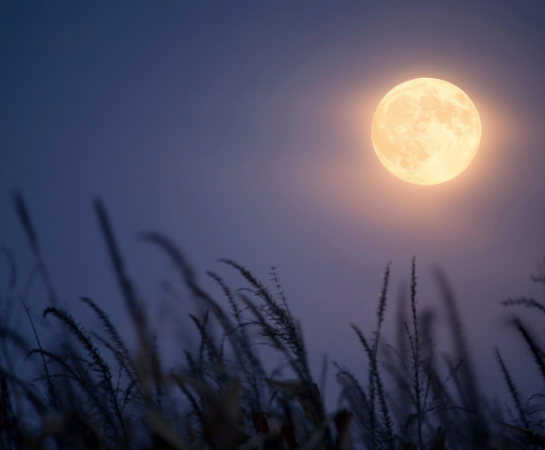
What Is a Harvest Moon and Why It Rises at Almost the Same Time Several Nights Running
On most nights of the year, the Moon rises roughly 50 minutes later than it did the night before. Around the Harvest Moon, that gap collapses to as little as 10 minutes in parts of the UK and Canada, and rarely more than 30 minutes
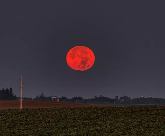
What Is a Blood Moon and Why Does the Moon Turn Red
On the night of August 27, 2026, the Moon came within a hair of disappearing entirely. Earth's shadow covered 96.2% of its surface, a partial eclipse so deep that skywatchers across the Americas, Europe, and Africa watched it turn a rusty, almost total red without

The Hour That Happens Twice: What Actually Occurs at 1:30 AM When Clocks Fall Back
At 1:59:59 a.m. on Sunday, November 1, 2026, clocks in New York will not tick over to 2:00. They will jump back to 1:00:00 a.m., and the next 60 minutes will replay. Every time from 1:00 to 1:59 happens twice that night, once on Eastern

Why the International Space Station Runs on UTC Instead of Local Time
Astronauts aboard the International Space Station see the sun rise and set 16 times in a 24-hour period, once every 90 to 93 minutes, as the station circles Earth at roughly 28,000 kilometers per hour. No conventional time zone survives contact with that kind of

Standard Time vs Daylight Time: What’s the Actual Difference
Most people assume "Standard Time" is the normal, default setting and "Daylight Time" is some separate seasonal overlay that temporarily replaces it. That mental model is backwards in a way that federal law makes explicit, and once you see the actual legal language, the whole

Why the Hour Was Originally a Different Length in Summer and Winter
For most of recorded history, an hour was not a fixed amount of time. It was a fraction, one twelfth of however long daylight happened to last that day. In June that fraction stretched past 80 modern minutes. In December it shrank to barely 40.
Time Tools
Quick access to timers, stopwatch, world clock and time zone tools.
Time Guides
Read useful guides about time zones, calendars, finance and astronomy.


